Geography is an interesting and complex subject, but unfortunately, there are many common myths about it that can lead to confusion and misunderstanding. There are many myths about geography that have been perpetuated by the media, the Internet, and even textbooks. Here are 10 of the most common geography myths:
10- Statue of Liberty
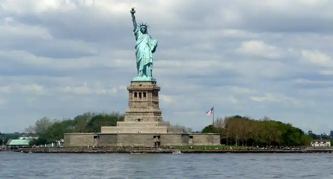
The Statue of Liberty, one of the most iconic landmarks in the United States, is commonly associated with New York City. However, this is not the case. The Statue of Liberty is actually located in the state of New Jersey, on a 12-acre island in Upper New York Bay. The island is known as Liberty Island, and the Statue of Liberty is accessible from both New York and New Jersey. Although the Statue is often associated with New York, it was a gift from France to the United States, and was meant to symbolize friendship between the two countries. The Statue of Liberty has long been a symbol of hope, freedom, and opportunity for people around the world. Despite its location in New Jersey, the Statue of Liberty remains a beloved symbol of New York City.
9- India’s Magnetic Hill

The Magnetic Hill of India is one of the popular geography myths, located in the Indian state of Ladakh. It is said that any object placed on this hill will start to roll up the hill, despite the fact that it is actually an optical illusion. It is believed that the hill has magnetic powers, though scientists have debunked this theory. The illusion is caused by the surrounding landscape and the fact that the hill is slightly sloped. As a result, it appears to be an uphill slope when viewed from a certain angle. Tourists and locals alike flock to the hill, eager to witness the mysterious phenomenon.
8- Africa A Country
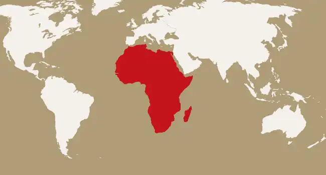
Africa is often wrongly referred to as a single country, when in reality it is a massive continent made up of 54 countries, each with its own distinct culture, customs and geography. From the sprawling savannas of Botswana to the lush rainforests of the Democratic Republic of Congo, Africa is a land of immense diversity. Each country has unique climates, landscapes, and wildlife, making the continent a perfect destination for travelers looking for something new and exciting. From the snow-capped peaks of Kilimanjaro to the majestic Victoria Falls, Africa offers a wealth of incredible experiences. The continent is also home to some of the oldest civilizations in the world, with Egypt and Ethiopia boasting thousands of years of history.
7- England & United Kingdom
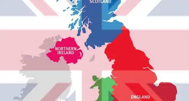
Photo Credit: Jagran Josh
England is a country within the British Isles, located on the island of Great Britain. It is bordered by Wales to the west, and Scotland to the north. The United Kingdom is a sovereign state, comprising England, Scotland, Wales, and Northern Ireland. The UK is a unitary state governed by a single government and Parliament, located in London. England is the largest and most populous of the four constituent countries, and the majority of the population resides in England. The English language is the official language of the UK and is spoken by the majority of the population. England’s geography is varied, with lowland areas in the south and mountainous regions in the north. The country is also home to many rivers, including the Thames, which is the longest river in England. England is also home to a variety of mythology, including tales of King Arthur, Robin Hood, and Beowulf.
6- Deserts Are Hot
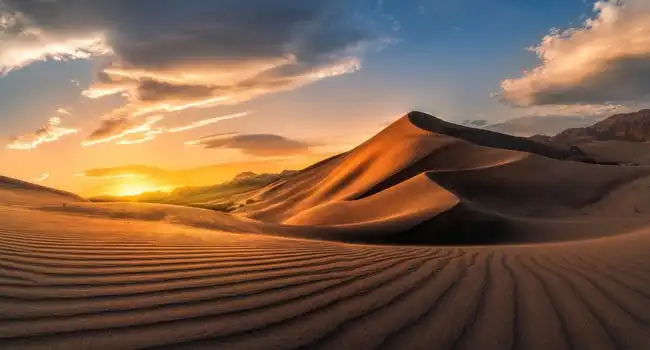
Deserts are often thought of as hot, arid places. In reality, not all deserts are hot. Some deserts experience temperatures that range from extremely hot to freezing cold, depending on the season and location. For instance, the Gobi Desert in Mongolia has temperatures that can reach over 100°F in the summer and drop to -40°F in the winter. Even more surprisingly, the Antarctic Desert, located in the southernmost region of the world, is technically the largest desert in the world. Temperatures in the Antarctic Desert can range from a balmy 50°F in the summer to an icy -112°F in the winter. It’s also worth noting that many deserts experience a greater range of temperatures than non-desert regions due to their lack of vegetation and clouds to block the sun’s rays. These varied temperatures make it difficult to characterize deserts as always being hot.
5- Greenland vs Africa
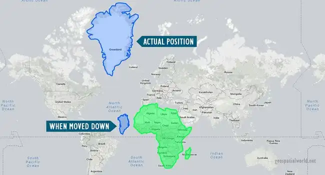
Photo Credit: Geospatial World
Greenland is often mistaken for being the same size as Africa, but the reality is quite different. Contrary to popular belief, Greenland is only about one-fourteenth the size of Africa. This misconception can be attributed to the fact that both continents appear to be similarly sized when looking at a standard Mercator map. However, this map projection distorts the true sizes of landmasses, making Greenland appear larger than it really is. In reality, Greenland is approximately 2,130,800 square kilometers while Africa is a whopping 30,370,000 square kilometers.
To put this into perspective, Africa is 14 times larger than Greenland. To make matters even more clear, Greenland would need to be combined with 14 other countries of similar size to match the size of Africa. This is why it is important to be aware of the limitations of different map projections and to look at the true sizes of landmasses before drawing any conclusions.
4- Holland is a Country
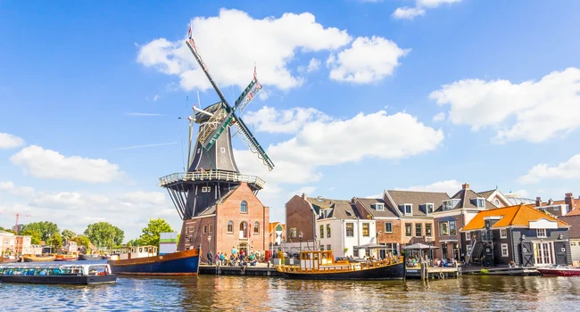
Contrary to popular belief, Holland is not a country; it is actually an informal name sometimes used to refer to the Netherlands. The Netherlands is a small country located in Northwestern Europe, bordered by Germany to the east and Belgium to the south. The Netherlands is home to 17 million people, making it one of the most densely populated countries in the world. Its capital city, Amsterdam, is known for its picturesque canals and gabled houses. The Netherlands is also famous for its tulips, windmills, and cheese. The Dutch language is the official language of the country, and is spoken by the majority of the population.
3- Jamaica is in Africa
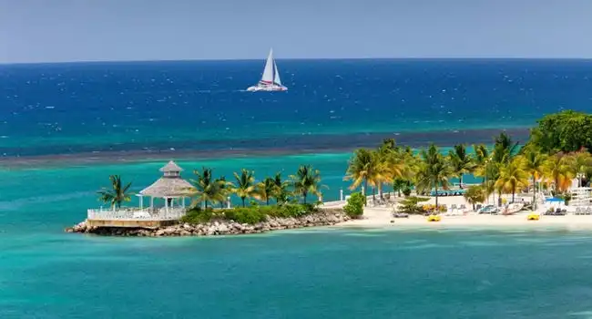
One of the most popular geography myths, that Jamaica is in Africa is false. Jamaica is an independent nation located in the Caribbean Sea, near the island of Hispaniola. It is part of the Greater Antilles and is the third-largest island in the region. Jamaica’s closest landmass is Cuba, which is about 145 kilometers away. Jamaica has a rich history, with its earliest inhabitants being the Taino people. In 1655, the British invaded Jamaica, and it eventually became a British colony in 1670. Jamaica gained its independence from the United Kingdom in 1962 and became a member of the Commonwealth of Nations.
2- Great Wall Of China
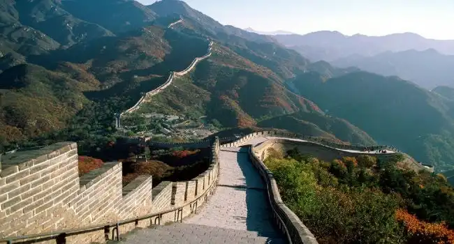
The Great Wall of China is one of the most iconic and notorious landmarks in the world. It is widely believed that the Great Wall can be seen from space, but this is actually a myth. Although the wall is 5,500 miles long, it is not visible to the naked eye from space because it is not as large and thick as many people think. The myth may have started because of its vast length and its visibility from airplanes. From the ground, it is an impressive sight, but from the perspective of the International Space Station or a spacecraft, it is nothing more than a thin line.
1- America is a Country
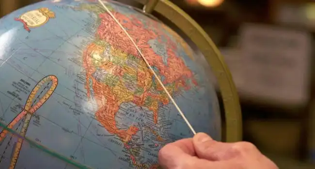
Photo Credit: CBS News
The myth that the Americas is a single country has been around for centuries, but this simply isn’t true. The Americas are two distinct continents, North America and South America. North America is home to countries such as the United States, Canada, Mexico, and Guatemala. South America, meanwhile, consists of countries like Brazil, Argentina, Colombia, and Ecuador. Although the two continents are geographically close to one another, they are two distinct land masses with vastly different cultures, languages, and histories.
The Americas are also home to a variety of climates and terrains. North America is generally known for its temperate climate, while South America is home to tropical rainforests, the Amazon, and the Andes Mountains. The two continents are also home to numerous islands, from the Caribbean to the Galapagos Islands off the coast of Ecuador.


